-
City Hall
-
- Common Council Meet Your Council Meeting Information Boards & Commissions Agendas and Minutes Vacancies City Manager City Staff Departments Administration City Assessor City Clerk Elections Finance Airport Community Development Housing Authority
- Departments Communications Fire New Fire Facility Project Library Museums Parks & Recreation Mound View Campground Event Center Parks Pool/New Pool Project Recreation Senior Center Police Public Works City Cemeteries Water & Sewer City Staff Directory
-
Budgets
Municipal Code
Job Opportunities
Bids and RFPs
Platteville Places (GIS)
Forms, Permits and Applications
Documents, Reports,
and Presentations Parking Elections
-
-
Business & Development
-
-
Bring Your Business
Here Municipal Code Platteville Transit Platteville Airport New Development Comprehensive Plan Development and Zoning Application Fees Current Projects New Housing Fee Report - Downtown Downtown Revitalization Plan Historic Preservation Plan Downtown Reserved Parking Main Street Redevelopment Authority TIF Districts Forms, Permits and Applications Bids and RFPs
- Economic Development Partners Platteville Regional Chamber Platteville Business Incubator Platteville Area Industrial Development (PAIDC) Grant County WI Economic Development (GCEDC) Wisconsin Small Business Center Wisconsin Women's Business Initiative Wisconsin Economic Development Corp. (WEDC)
-
Bring Your Business
-
-
Our Community
-
- Welcome to Platteville Life in Platteville New Residents Community Kudos Demographics History Local Businesses Things to Do Upcoming Events Farmer's Market Library Museums Parks & Recreation Pool Senior Center Tourism Biking & Hiking ATV/UTV Routes
- Services Services A-Z Elections & Voting Broske Event Center Rentals Auditorium Rental Garbage & Recycling Parking Information Dog Licensing Platteville Places (GIS) Public Transportation Submit a Request or Concern Yard Waste Public Safety Police Fire Parking
- Community Organizations Platteville Regional Chamber Main Street Program Platteville Community Arboretum Rountree Gallery PATH Current Projects Schools Platteville School District University of Wisconsin-Platteville Southwest Tech Food Pantry Resources
-
-
Connect
-
- Contact Us Submit a Request or Concern Submit a Community Event City Staff Directory Department Contacts Job Opportunities Alerts and Notifications Email Subscriptions CodeRED Alerts New Residents
- Online Resources Agendas and Minutes Calendar Municipal Code Documents, Reports, and Presentations Forms, Permits, and Applications City News In The Spotlight 53818 Update Newsletter
- Social Media Facebook City Library Museum Parks and Recreation Police Pool Senior Center Twitter City Library Police
-
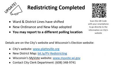
2021 Redistricting Completed
Redistricting takes place every ten years following the census. It is the process by which electoral district boundaries are redrawn periodically to adjust for shifts in population and to ensure proper representation for all potential voters in the given geographic area. This is accomplished by states adjusting the congressional and legislative districts boundaries, counties adjusting county supervisory district boundaries, and municipalities adjusting ward boundaries based on the census data.
Due to complications from the pandemic, the federal government’s release of census population data in 2021 was significantly delayed, which resulted in a compressed timeline for all counties and municipalities.
On October 5, 2021 the Grant County Board approved a tentative Supervisory District Map. Using the census data, tentative Supervisory District map, and statutory guidance, City staff produced a proposed City of Platteville map that includes the updated Wards and Aldermanic Districts. The boundary descriptions were drafted according to the map and updated within the attached ordinance.
On October 26, 2021 the Platteville Common Council voted to approve the adoption of the new District Map and Ordinance 21-08 as presented during the meeting. Notice of this ordinance adoption was then published in The Platteville Journal on November 3, 2021.
Click here to view the City GIS map. Select the Voting - Aldermanic District from the Layers List then search your address to view your updated information and polling location.


